
Google Earth is a great viewer for flight tracks. While GPX files can be imported into GE, they do not look appealing – and lack useful information.
Enter gpsvisualizer.com: a free online service to convert GPX files to the GE KML format (among many other features). I mostly use the Convert your GPS data for use in Google Earth service to visualize flights with these settings:
- Google Earth doc name: start, destination & day of flight
- Colorize by: Speed
- Altitude mode: Absolute (for flights)
- Draw a shadow: 30% opacity – yields an actual track over ground
Tip: click Save these settings and next time all settings will be restored.

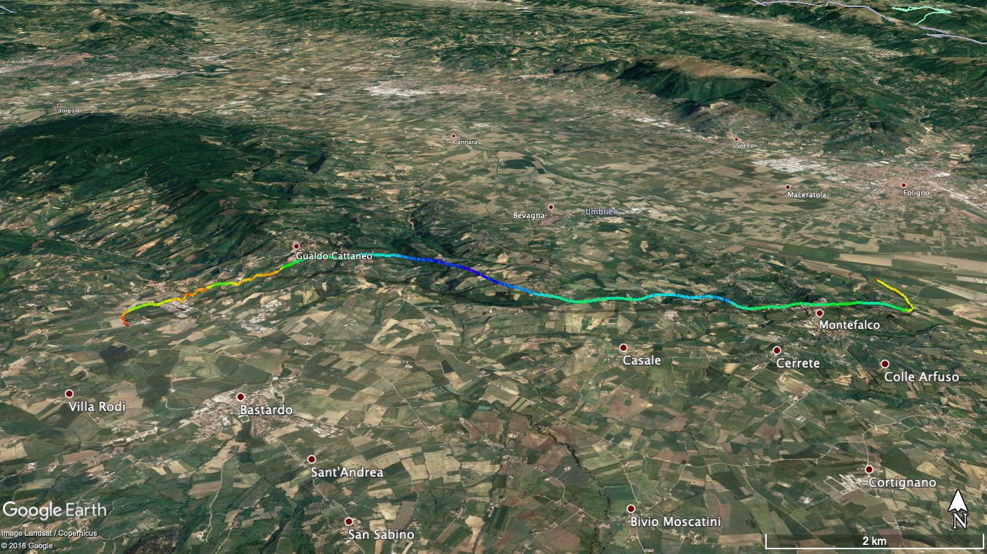
The result is a compressed KML file which looks like so when openend in Earth:
Update:
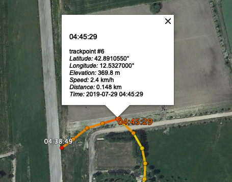
Many GPS sources create lots of trackpoints – so much that the resulting tracks look like a series of balls. Way too dense to be useful.
Also, the line segments generated by the settings above lack useful information (just text like ‘trkpt 660’). Adding waypoints in gpsvisualizer adds more detail.
Hour marks, as well as time stamps for takeoff and landing time are lacking above.
A good setting to deal with these issues is:
- “Trackpoint distance threshold” : 20m
- “Draw as waypoints”: Yes, named with timestamps
- “Tickmark interval”: 1h
- “Zero distance mark”: Yes (this field only appears when you enter a value into “Tickmark interval”)
This gives us waypoints every 20m (good enough) and klicking them in GE reveals useful information:
The updated result file can be downloaded here.