So you had a great flight. You unload your GPS and now have a GPX file. How do you share the experience with others?
Well, draw it on a map like so:
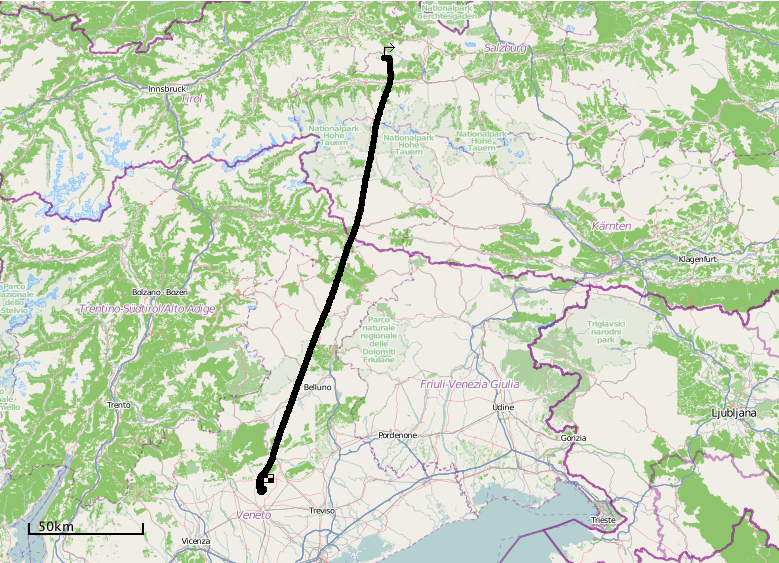
Pretty bland, if you ask me – “yes, we’ve been here and there too”. in Flatlandia, that is. The dynamics of the flight experience, great views – gone.
You could generate a KML file and tell folks to view it in Google Earth. Works, if they have Earth installed – which translates into “almost nobody”. With an advanced degree in Earth, you can even create an animation video. But that takes time and lots of moving files around.
What I’m looking for is – send out a link, and everybody with a browser at hand could re-live the flight, drag, pan, and zoom around like so:
and.. also be able to embed this on a web page.
Do-it-yourself like so:
- create a free account on Rikitraki.com
- upload your GPX file
- click the “3D” icon and the Play button
That’s it!
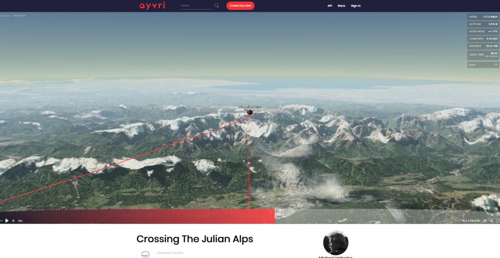
Another option: ayvri.com
Turns out there are several sites which provide similar services. Ayvri.com also sports free accounts, with the option to upload GPX files. Other than rikitraki.com ayvri optionally displays current flight data (speed, altitude, climb/sink rate, distance, time) – very nice!
Click the image below to run the actual animation on ayvri.com:
Pretty much the same drill as above:
- create a free account on https://ayvri.com
- upload a GPX file and describe the flight
- click “Create Scene”
- click the “Stats” dropdown (right top) for flight data
- view the animation
- record its URL for sharing.
While rikitraki seems to be more of a single-programmer hobby project, ayvri looks more professional and polished, with a company, free/paid options, an API and a Twitter & Facebook presence behind it.