How would you distribute windy trajectories during weather briefings at balloon events? You did save the result as GPX file. And now what?
Paper: meh. Display screenshot on projector? confusing spaghetti. Post a KML or GPX file on a whatsapp group? hardly anybody could open such files on their mobiles and pads.
Pretty easy with GPSVisualizer:
- upload the GPX file so it is Internet-accessible and note its URL (e.g. as a WordPress media file – here’s an example GPX file for you to play with)
- goto GPSVisualizer.com and paste the URL of the GPX file into the “Send a file to The Atlas” field:
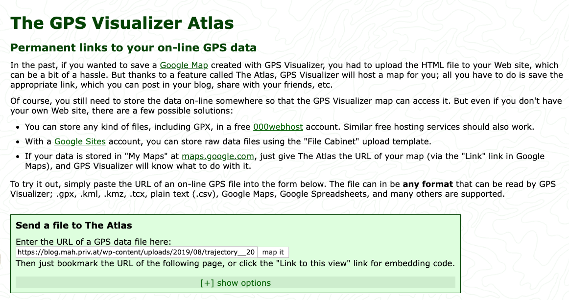
- hit the “map it” button – you should see something like this:
That’s thew view you’d want to distribute – people can pan and zoom around, and select/deselect heights and models in the trajectory set.
To create a URL for this view:
- Click the blue “Link to this view” field at the right bottom:
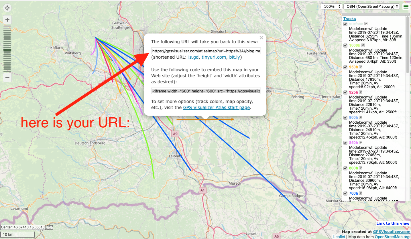
And here is the URL which you can post online – displaying the above map.
Edit: There is currently a minor bug in the GPSvisualizer web service – uploaded tracks vanish after a certain time, and the message ‘File … contains no usable data’ is displayed.
To work around this issue, add ?cache=0 to the Atlas link like so.